|
Connecting you with tools, best practices, and resources to know what you have, plant and care for trees, and protect your canopy.
Newsletter Summer 2018 | View Newsletter Archives
Welcome to our Special Feature on Tree Canopy Tools!
As we wrap up the summer season and gear up for fall plantings, we highlight in this issue some of the innovative tree canopy datasets and tools available through partners across the Chesapeake region.
We are fortunate that in the Chesapeake, we have ready access to “wall-to-wall” high resolution land cover data for the entire watershed. These datasets include tree canopy data layers that you may use in combination with different local GIS data layers to do custom urban tree canopy analyses for your town, county, or other place of interest. And what’s more, the Chesapeake Bay Program partnership commits to updating these land cover data approximately every 5 years.
> Learn more and access land cover datasets
The Land Use Classification used for the Chesapeake Bay Phase 6 Model and TMDL (Total Maximum Daily Load) incorporates this high resolution land cover data.
> View and download these land use data here.
The i-Tree Landscape tool now integrates the high resolution Chesapeake tree canopy data as well, so that users without GIS may quickly generate land cover statistics, calculate ecosystem services (air, water, carbon, etc.), and prioritize census blocks or other units based on demographic and environmental factors. View this webinar recording to learn how to start using i-Tree Landscape.
Please be in touch. If you have follow up questions or ideas related to tree canopy data and tools, we will try to connect you with the right partner. We know there are other great examples around the region, so if you would like to submit a story idea for a future newsletter story, let us know at info@chesapeaketrees.net.
|
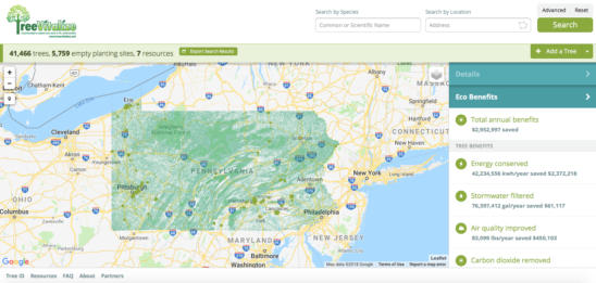
PATreeMap – 40,700 trees and counting!
The Pennsylvania Community Tree Map (PATreeMap) is a free, online cloud-based mapping tool that can conduct and store tree inventories at the local level. Individuals and communities in Pennsylvania are using the map to learn about their existing tree canopy, understand its benefits, report real-time changes, and monitor the canopy over time.
Read More
|

D.C.: Using leading edge tools to manage our Capital’s canopy
D.C. is a leader in the Chesapeake Bay region in the creation of innovative tools to leverage their urban forestry efforts. The Urban Forestry Division at the District Department of Transportation recently published a suite of applications that improve on how they manage their street trees and communicate information to the public. In addition, Casey Trees is producing a comprehensive tree inventory of D.C. public parks with the support of volunteers.
Read More
|

Baltimore: First urban tree canopy change analysis completed
An urban tree canopy (UTC) change analysis is an important tool for helping communities monitor changes in tree cover and track progress toward achieving canopy goals. A recent UTC change analysis of Baltimore, Maryland shows tree cover in the city increased from 27 to 28 percent over an eight-year period. Along with this exciting discovery, the analysis led to valuable insights on the nature of the gains and losses in Baltimore’s UTC.
Read More
|
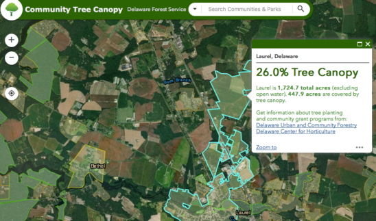
Delaware: State develops Community Tree Canopy Online Tool
Delaware is making high-resolution imagery more accessible at a local level with the Community Tree Canopy online tool. Municipalities, homeowner associations, and neighborhoods may now use this tool to measure, manage, and promote their tree canopy.
Read More
|
|
|
|
|
|
|
