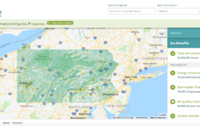
Recent developments in technology have made it easier and less expensive to acquire high-resolution land cover imagery for tree canopy assessments at state and regional levels. However, this kind of data is not always readily available for smaller communities to use. The State of Delaware has taken the initiative to make high-resolution imagery more accessible by creating the Community Tree Canopy online tool. The state developed this tool specifically for municipalities, homeowner associations, and neighborhoods to use to measure, manage, and promote their urban tree canopy.
Jim Kroon (Delaware Department of Agriculture) and the Delaware Forest Service made the Community Tree Canopy tool by using geographic information system software and statewide high-resolution land cover data. The University of Vermont Spatial Analysis Lab generated the land cover data by using a combination of LiDAR, leaf-on, and leaf-off remotely-sensed imagery. Funding for this dataset came from the William Penn Foundation and Shippensburg University.
The resulting tool allows users to zoom into areas of interest or directly search for communities and parks. By clicking on different cities, towns, and parks, users get basic statistics on how much of the land is covered by tree canopy. Communities can assess current distributions of tree canopy and identify locations that lack trees. They can then use this type of information to guide their tree planting and management decisions.
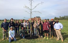
The Community Tree Canopy online tool serves as an additional resource that Delaware communities can use to meet and maintain their tree canopy goals. Over the past few years, the Delaware Forest Service assisted local governments to set such goals. Greenwood, Georgetown, Blades, Laurel, and Delmar in the Chesapeake Bay watershed are among the list of communities that committed themselves to a tree canopy resolution. For some of these towns, the improved imagery from the Community Tree Canopy online tool calculated a higher canopy cover than estimated through prior assessments. This finding opened up an opportunity for the towns to revisit and revise their goals if needed. State Forestry staff are continuing to work with the communities to help them fine-tune and meet their goals.
The Community Tree Canopy tool also directs users to grant opportunities offered by the state by including links to the Delaware Center for Horticulture and Urban and Community Forestry websites. According to Kesha Braunskill, Urban Forestry Coordinator at the Delaware Forest Service, communities at the neighborhood level are taking advantage of these opportunities and are using the tool to advocate for funding. “We have seen homeowner associations reference this tool when submitting for grant funding for tree planting projects in their communities,” said Kesha.

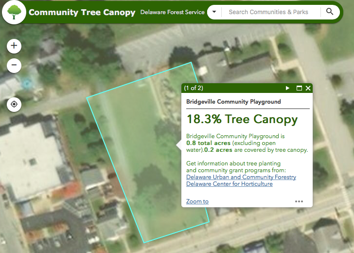
In summary, Delaware’s Community Tree Canopy tool offers high-resolution imagery and data that stakeholders can use to zoom into areas of interest and assess their local tree canopy. The tool provides local governments, neighborhoods, and other groups with the data needed to justify and evaluate their tree initiatives. To learn more about the tool, visit http://delawaretrees.com/tree-canopy-tool/.
Story written by Tuana Phillips