|
Connecting you with tools, best practices, and resources to know what you have, plant and care for trees, and protect your canopy.
Newsletter Summer 2020 | View Newsletter Archives
Welcome and Happy End of Summer!
We are nearing the season’s end, and I am grateful to soon leave behind the extreme heat that has plagued the region for the past two months. If you think it feels hotter than usual, you are right: as noted by Sadie Francis in this month’s story on the connection between increased heat vulnerability to unjust urban planning, 2020 has set new records for maximum temperature and duration of heat waves.
Our offerings in this edition of the newsletter focus on the research into urban heat islands – a phenomenon where land and air temperature are higher in urban areas due to the abundance of surface that absorb and radiate heat – that are disproportionately experienced by low-income communities of color. This heat disparity is the result of decades of unjust urban planning, and observed within many cities in the Chesapeake Bay watershed and beyond. These same cities are using this research to design cooler cities with shade equity through tree canopy and green spaces.
If you are interested in learning more about how other Chesapeake communities are responding to climate change, including its human effects and ties to public health, human migration, and social justice, consider registering for this year’s Chesapeake Watershed Forum (virtual; October 29 – 30, 2020). This year’s Forum includes a session on heat, health, and trees and features researchers presented in this newsletter. Click here to learn more.
|

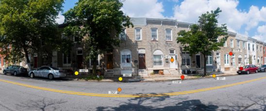
Relief From the Heat: In Rapidly Warming Cities, Trees Can Save Lives
New analyses of urban heat islands are widening our scope of understanding of the relationship between historic urban planning practices and how different urban neighborhoods experience extreme heat, further revealing how the past is continually delivering us to the present day’s inequities and environmental injustices.
Read More
|

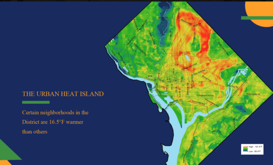
Planting for the Climate of the Future: Washington, D.C.’s Efforts to Counter Urban Heat Islands
Washington, D.C. is using heat mapping and modeling overlaid with demographic data to identify the city’s most exposed and sensitive populations to extreme heat. The city is using this data to better prioritize and direct urban greening first towards these vulnerable populations.
Read More
|
|
|
|
|
|
|


