When it comes to building innovative tools to leverage urban forestry efforts, D.C. is a leader in the Chesapeake Bay region. The Urban Forestry Division (UFD) at the District Department of Transportation (DDOT) recently published a suite of applications that improve how they manage their street trees and communicate information to the public. In addition, Casey Trees is leading citizen scientist volunteers in the production of a comprehensive inventory of trees in the District’s public parks. This effort will help the city learn about those trees and ensure an enduring canopy on its park lands.
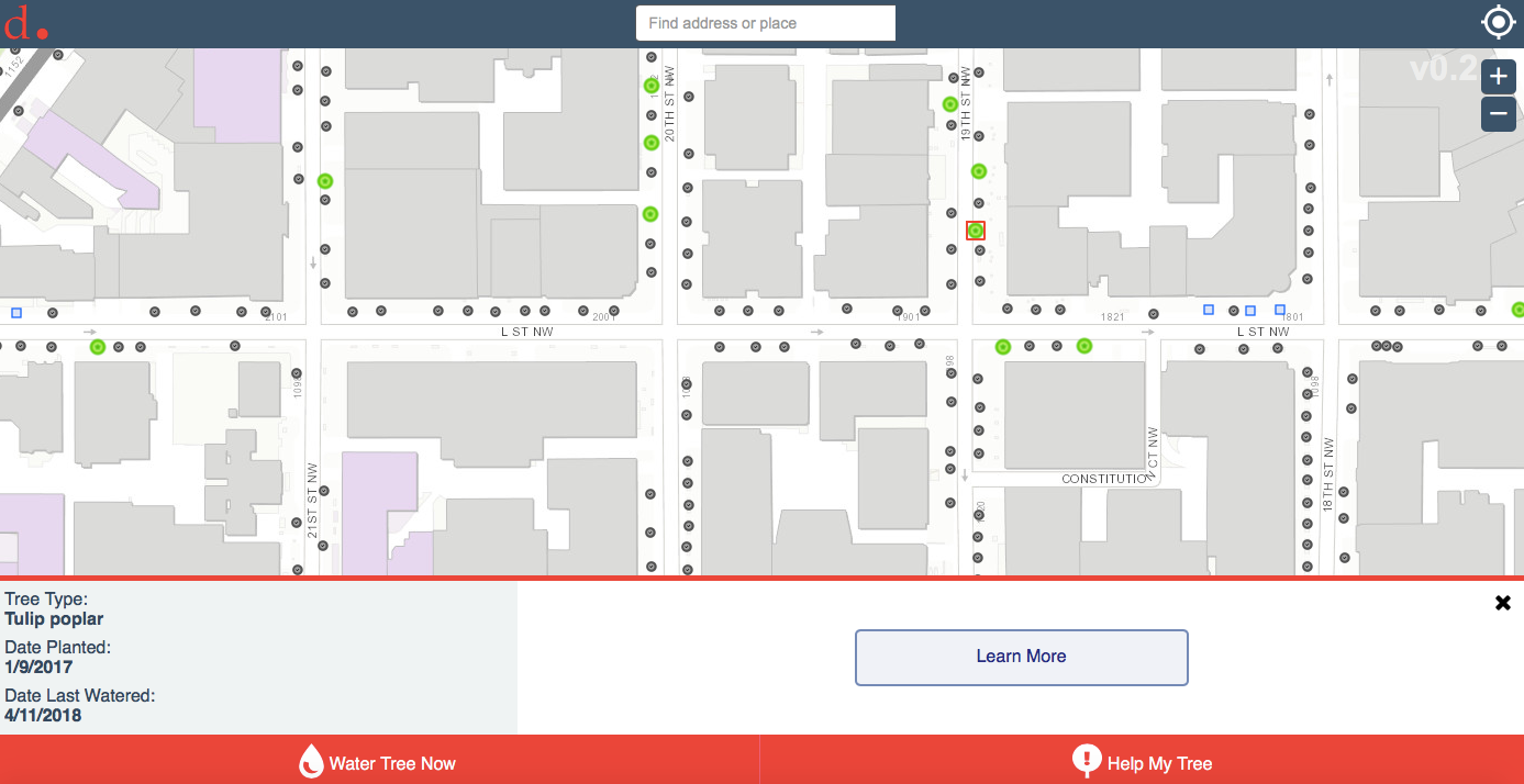
The DDOT UFD’s mission is to manage and increase the District’s street trees to maintain the healthy trees that provide numerous benefits to the community. The UFD is currently planting more than 8,000 trees every year, installing four to five new trees for every tree removed through the DDOT’s standard infrastructure repairs and new construction. Because newly planted trees require a lot of maintenance and watering in their first few years, the DDOT created a Watering App as a way that residents can get directly involved in caring for young trees on their blocks. The app identifies trees in need of watering and includes directions on how to properly water the tree. Users can see when trees were last watered, report new watering activity, and even upload a picture of the tree they have watered.
D.C. has developed additional tools that streamline their operations. The UFD receives over 13,000 tree service requests per year and as many as 500 or more after large storm events. With a limited amount of resources, the UFD relies on a GIS-powered asset management system to address all requests as efficiently as possible. The spatial nature of this tool enables staff to analyze and aggregate multiple reports in one area in order to respond using a single, coordinated approach. They can also identify priority service locations based on proximity to major corridors or critical facilities such as hospitals.
In addition, the UFD uses a variety of dashboards to track their work. These public dashboards provide additional insights into their operations by monitoring the number of street tree removals, street tree plantings, and overdue inspections.
The UFD designed other urban forestry tools to disseminate information to members of the public, as well. Taking advantage of Esri’s Story Maps platforms, the UFD built interactive web stories that tell powerful and inspiring messages about the city’s canopy. One story map gives the history of trees and urban tree canopy in D.C., while another story map takes viewers on a virtual exploration of the city’s 60 most common street tree species.
A Street Trees map allows citizens to click on individual street trees to get information on the tree’s common name, current condition, and size. The UFD keeps this map up to date by using an ArcGIS mobile app that uploads real-time data as they are collected. As reported by Earl Eutsler (Associate Director, UFD), the map receives an average of 30-45 views per day.
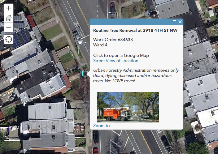
For those more curious about the management status of their local canopy, the DDOT’s Tree Services Schedule website page includes maps of scheduled street tree removals and plantings. Not only can residents view these upcoming changes, they may also request street tree services such as pruningand removal by calling 311 or visiting the DC311 website portal. Residents may also request a tree planting in any open street tree spot in the city. The UFD will then plant a tree at the location for no charge.
The UFD’s sophisticated tools and data help the city manage and increase the urban street canopy. Casey Trees has been another key partner in contributing to this mission. The organization previously worked on an inventory of the District’s street trees and devoted many years to tree plantings and maintenance. Although these efforts were successful, they noticed a gap in information about all of the trees located in D.C.’s public parks.
Therefore, in 2015, Casey Trees started a pilot to train citizen scientist volunteers to inventory the trees in public parks. Volunteers were taught how to identify tree species, take tree measurements, and record their data in an ArcGIS collector app. After collecting accurate inventory data in two parks and having a great time with volunteers in 2015, Casey Trees ramped up their efforts. They worked with the UFD, the National Park Service, Department of Parks and Recreation, Gallaudet University, and George Washington University to partner with landholders and expand their work into other parks. In 2017, over 200 volunteers inventoried 6,378 park trees at 55 different locations.

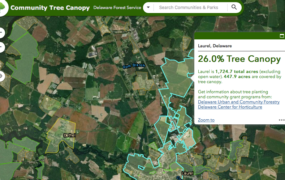
The Casey Trees park tree inventory program presents a great opportunity to engage the public in urban tree stewardship. In addition, it provides new knowledge that will be instrumental to the UFD’s work in the future. Due to recent legislation in the District, the UFD now has management authority over the trees in public parks. The park tree inventory will allow the UFD to learn about the condition of the District’s park canopy and make strides toward managing those trees in addition to the street trees that they already oversee. Thanks to this inventory and the UFD’s many urban forestry tools, D.C. is well-equipped to maintain healthy tree canopy across all of its neighborhoods and public parks.
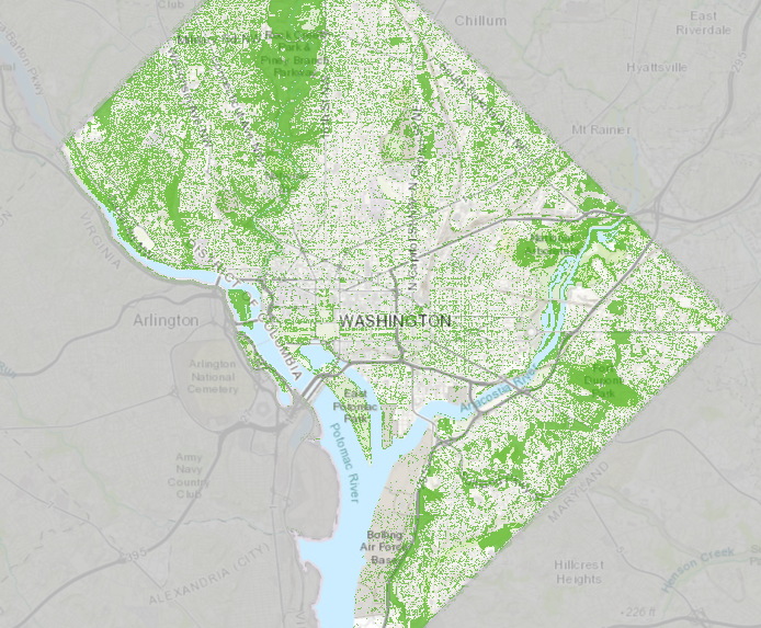
In addition to all of the stewardship underway related to the District’s public trees, the UFD also serves as the lead agency in helping the city achieve its Urban Tree Canopy (UTC) Goal of 40%. To that end, UFD conducts high-resolution land cover assessments for D.C.. Three of these studies have been conducted since 2006, occurring at five year intervals. By regularly reassessing the city’s land cover characteristics, the UFD may evaluate the effectiveness of the programs and policies in place that are aimed at attenuating private property tree removal, and ultimately enhancing and sustaining the UTC resource in the city. Thanks to a variety of critical factors, including robust municipal operations, effective partnerships with cooperators like Casey Trees and the U.S. Forest Service, as well as targeted private tree removal limitations, the District of Columbia has enjoyed vigorous tree canopy expansion in the decade since the first UTC assessment was conducted.
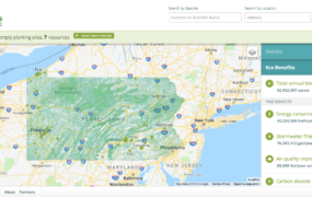
A link to a recent canopy viewer app, showing the latest UTC data, as well as the underlying information used to arrive at the results, is included below and can be found here: https://pg-cloud.com/DDOTUFA/
Related links:
http://www.esri.com/esri-news/arcwatch/0416/protecting-urban-forests-the-modern-way
https://caseytrees.org/2017/09/d-c-maps-you-didnt-even-know-you-needed/
https://caseytrees.org/2017/12/2017-park-inventories-recap/
Story written by Tuana Phillips