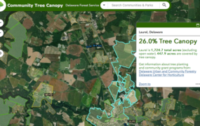
The Pennsylvania Community Tree Map (PATreeMap) is a free, online cloud-based mapping tool for conducting and storing tree inventories at the local level. Individuals and communities in Pennsylvania may use the map to learn about their existing tree canopy or contribute new information by reporting on individual tree conditions, adding new trees, marking empty sites, and entering other tree inventory data. The tool also helps users understand the benefits of their canopy and monitor changes in tree health over time.
The PATreeMap, which was developed by geospatial technology company Azavea (based out of Philadelphia, PA), plugs into Google technology, enabling users access to the most recent Google spatial imagery and street information. Its online interface is very user-friendly and accessible on mobile devices via the OpenTreeMap app. Users can search for trees by location or by species to learn about tree canopy across Pennsylvania.
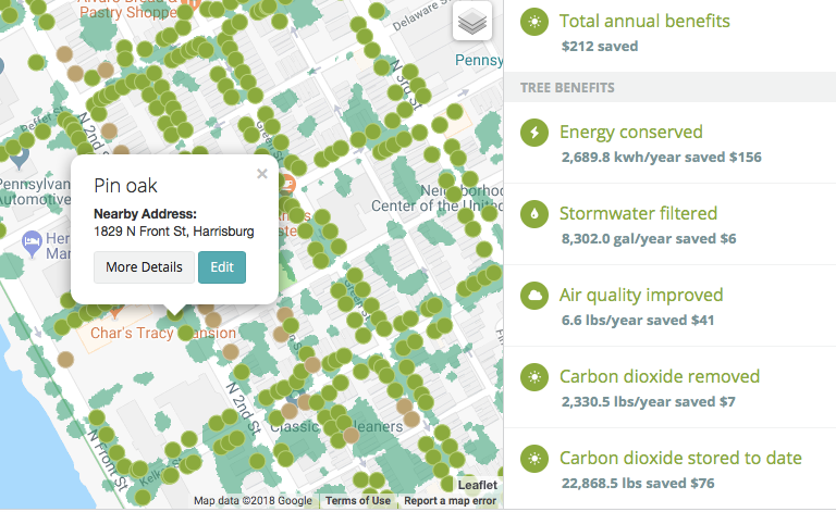
One of the tool’s major features is a “Tree Benefits” sidebar, designed with the USDA Forest Service i-Tree software to generate the economic and environmental benefits of trees. This feature lets citizens and communities assess the value of urban tree canopy by calculating how much money they save due to tree functions that reduce energy use, filter stormwater, improve water quality, and remove carbon dioxide. User-determined searches allow these calculations to be done at the individual tree level, community level, or at the state level.
Ever since PATreeMap launched in 2016, the Pennsylvania DCNR Bureau of Forestry has worked actively to promote the tool and get communities across the state to upload their local tree inventory data into the map. To date, the state is working with 35 communities, including 15 in the Chesapeake Bay watershed: Ephrata, Lancaster, Harrisburg, Derry Township, Laporte, Muncy, Orwigsburg, Pottsville, Annville, Susquehanna Township, Carlisle, York, Lemoyne, New Cumberland, and Wellsboro. The majority of the 40,763 trees currently reported in the tool have come from community inventory data. The benefits of these mapped trees in Pennsylvania amount to over two million dollars saved per year.

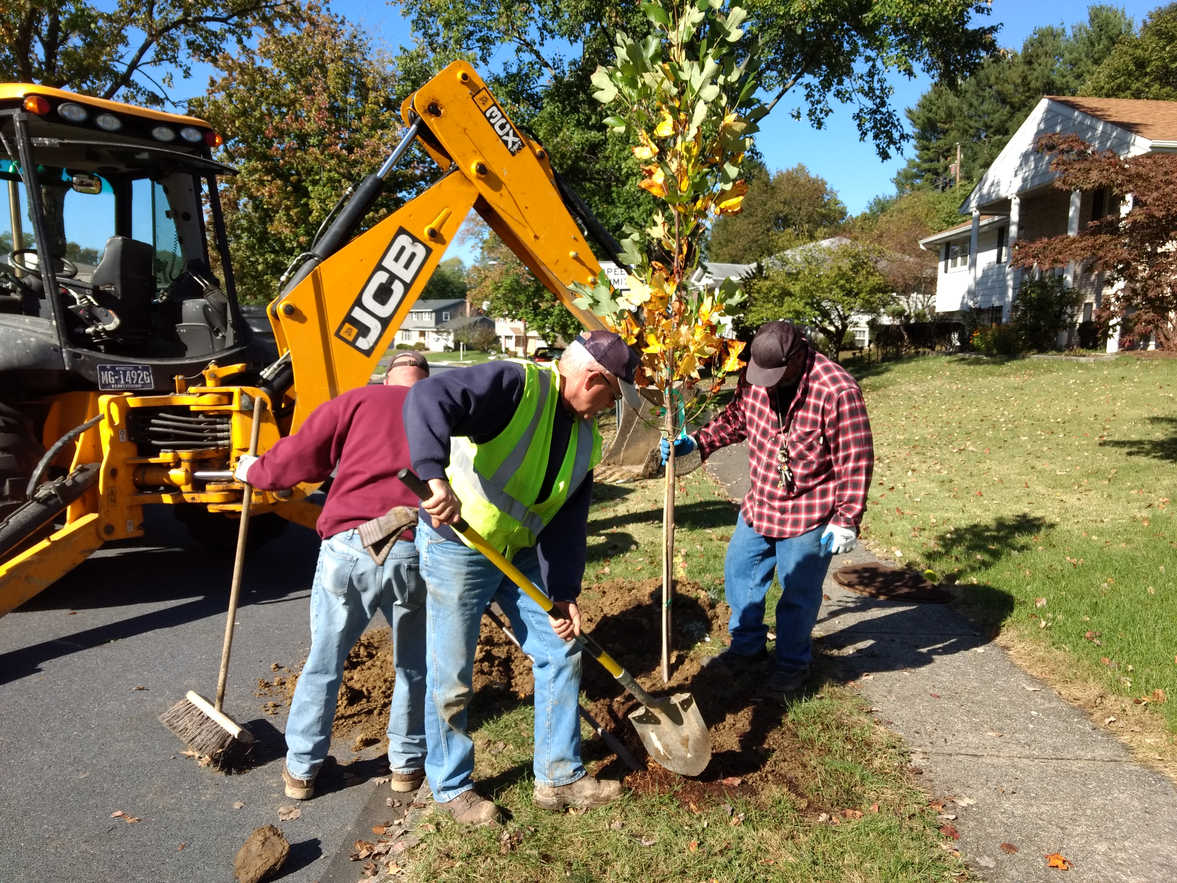
Pennsylvania communities are taking advantage of what PATreeMap has to offer by using the tool in many ways. In the Chesapeake Bay watershed, Susquehanna Township is documenting the locations of newly planted trees. Betsy Logan, Director of Community and Economic Development, said the Township is in the process of building a database of planted trees through the PATreeMap. They used the tool for the first time in the Fall of 2017 during a Township-sponsored tree planting event. They also use the tool to map rain barrel installations and other stormwater features, and as a platform to engage volunteers in tree stewardship.
The Borough of Ephrata is in the process of using the tool to conduct their first-every tree inventory. Chandra Mast, Chair of the Borough’s Shade Tree Commission explains, “We use PATreeMap to take photos of the trees, record multiple tree measurements, keep track of maintenance, and add notes about things we do to the trees like soil treatments and pruning.” In addition, the Commission uses the map to flag trees that require maintenance so that Public Works can attend to them in a timely manner.

For more information on the tool and possibilities for using it in more Pennsylvania communities, contact Mark Hockley. See also the 2017 Penn State University webinar recording for an in-depth introduction to the tool.
Story written by Tuana Phillips