Story by Sadie E. Francis
Every year, researchers estimated there were a couple of thousand premature deaths due to excessive heat in the United States. But in the last ten years, due to increasing temperatures and more robust research, this number has increased to up to 12,000 deaths per year. Death rates increase in cities with the high seasonal variability, longer heat waves, and high evening temperatures.
Climate modeling predicts that it only gets hotter from here: Washington, DC is on track for even longer, hotter and more frequent heat waves, with as many as three times the number of dangerously hot days. Even as I write this, I am regaled with daily heat-related records that are being shattered: DC has already logged more days over 90 degrees in one month than any other time in its recorded history, and we are only a little more than halfway through the summer season. Already, 2020 is set to be hottest or second hottest on record, further reinforcing the long-term trend of rising temperatures.
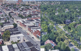
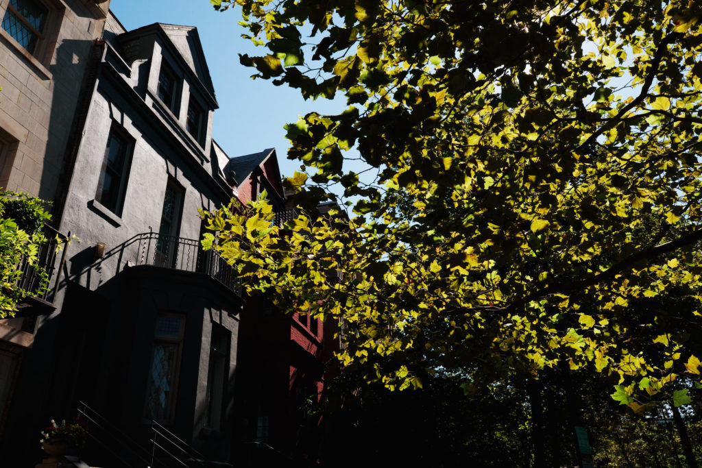
The myriad challenges presented by the changing climate are further complicated by the fact that the District’s population continues to grow – leaving the city grappling with the need to identify and implement cooling infrastructure solutions while also maintaining building density. Urban heat islands form when vegetation is replaced by surfaces, usually asphalt and concrete, that absorb and radiate heat, causing surface temperatures and overall ambient temperatures to rise. Narrow streets sandwiched by tall buildings can trap heat by reducing airflow. Heat given off by vehicles and HVAC units further contributes to the heat island effect.
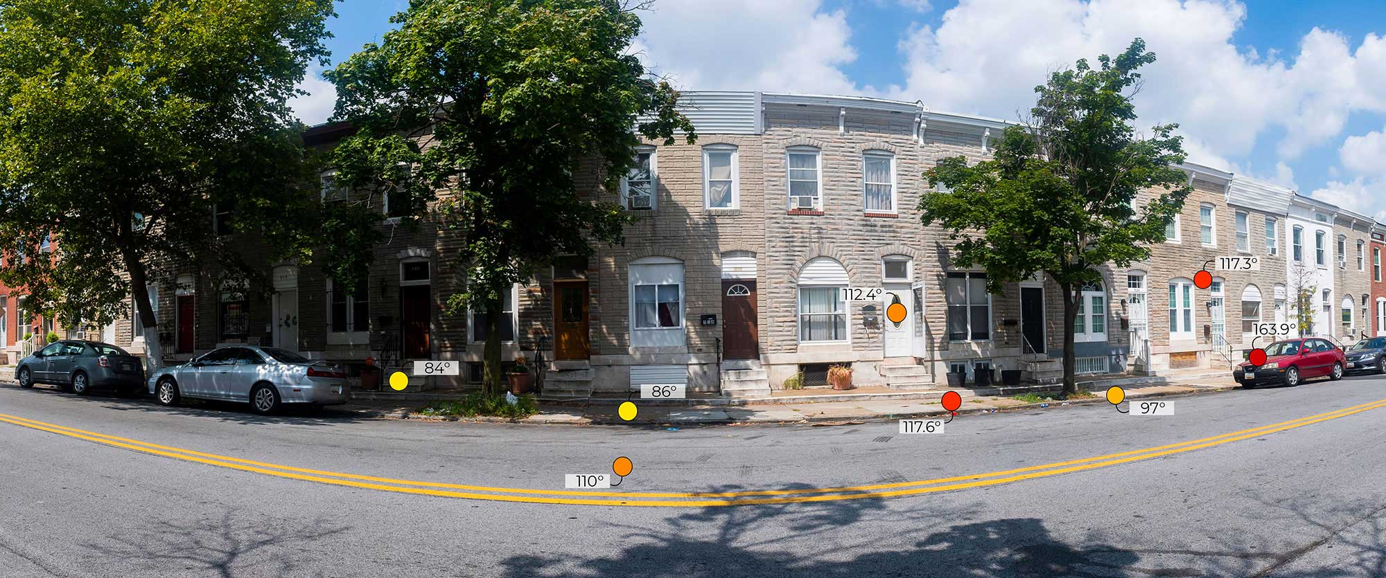
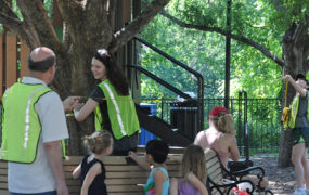
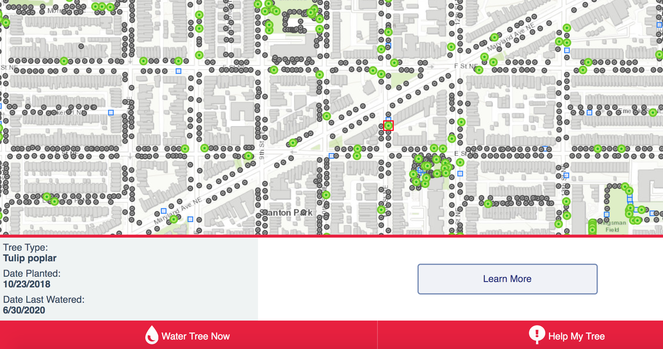
In Mayor Muriel Bowser’s Administration, the District of Columbia’s Department of Energy and Environment (DOEE) and Department of Transportation (DDOT) are currently working to develop a comprehensive heat policy to plan for, mitigate, and adapt to the new normal. One element of this effort is to engage citizen scientists in mapping the city’s “hot spots”, and evaluating those alongside the relative heat sensitivity of different population. Another effort uses heat modeling to discern any neighborhood-level design strategies that could provide cooling and ventilation benefits. Researchers from Portland State University in Oregon and the Science Museum of Virginia took the lead in organizing and collating heat-mapping data. Over the course of a single day in August 2018, using specially designed thermal sensors mounted on bikes and cars, citizen scientists drove prescribed routes through each city recording ambient air temperatures, humidity, time, and location. They incorporated this data in interactive maps that DOEE and DDOT use to better inform planning and mitigation efforts.
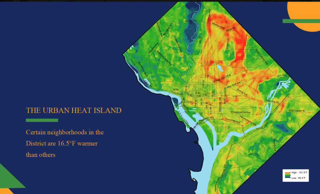
For instance, DOEE took the heat map and overlaid data sets incorporating a range of demographic data – age, obesity rates, and income, to name a few – and cross referenced all this data to determine the populations most exposed and the most sensitive to extreme heat. By mapping heat sensitivity onto heat exposure, DOEE is able to definitely identify the city’s most vulnerable residents, enabling DDOT to better prioritize and direct urban greening and other cooling solutions towards them, first.
“It was actually pretty surprising where heat is most densely held and concentrated: we anticipated the downtown areas to be the hottest, yes, but we have other residential areas with moderate tree canopies that are hotter than we thought,” commented Earl Eutsler, associate director of urban forestry at DDOT. “Certain types of infrastructure, like train tracks, become incredible corridors for heat.”
Preliminary results show that urban trees can cool down ambient air temperatures by as much as 10°F, confirming that trees are still the most effective investments in urban environments for not only moderating extreme temperatures, but all the other ecosystem services they provide. Some research even suggests that the mere presence of greenery can make people feel cooler. At present, most urban tree planting efforts are being concentrated in the areas on the heat map that experience the greatest urban heat island effects.
DDOT is overseeing several efforts currently underway to increase space for trees, like creating new tree boxes and expanding existing ones, and removing concrete sidewalks. Eutsler and his team are creating 200 new spaces every year, including continuous planting strips. Another initiative involves replacing impervious pavement with porous alternatives around trees to boost root health and viability while reducing root-related sidewalk damages. “We are also looking at right of ways, like highway onramps, that have large vegetative sections but were not planted with trees before. There are plenty of opportunities to improve and increase spaces in which trees can grow.”
“Can we build density while also keeping people cool?” asks Melissa Deas, a climate protection analyst at DOEE. “How can we integrate design considerations that mitigate heat?” As we see the increased use of air conditioning, which can serve as a short-term solution but adds to the long-term problem, analysts like Deas are also considering things like building design and site layout. Her office’s heat modeling project looks at temperatures at three sites under various scenarios and seeing if features like building heights, open space, tree canopy, green roofs, and even water features make any difference on temperature. Vivek Shandas, the same researcher behind the city’s heat mapping project, simulated the roles of these features over the different scenarios, providing insights about the thermal effects of landscape features. There are some big caveats – the modeling was done over the course of a single 24-hour period, for instance, not only a small data set, but also doesn’t incorporate any cumulative effects of several hot days – but it is a proactive way to think of and engage with the challenge of a rapidly changing climate.
Again, trees were shown to make the most difference, even were slightly more effective than vegetated roofs or highly reflective roofs (not to pit one strategy against another – multiple strategies can be employed). Adding buildings to a vacant grassy site does not necessarily raise the temperature of the surrounding air – on the contrary, by providing shade, added buildings can potentially cool a site, depending on their configuration.
The water feature was seen to have little to no significant impact, but an array of buildings of varying heights, which allow for improved air flow and increased shade, can actually can cool sites.
“As heat modeling results are verified, DC DOEE and DDOT will work to ensure that the green infrastructure interventions providing the greatest cooling benefits are incorporated into future development,” stated Deas. “And we are now doing heavy external engagement for our more comprehensive heat plan. We have a climate adaptation plan from 2016 in which we did some initial heat analysis, but not in any detail.” Meanwhile, Portland State University and their heat mapping partners are refining their methodology before launching a bigger national program, and developing a ready-made template that other city governments can use to affordably conduct their own urban heat island maps.
Earl Eutsler knows that the need for a vibrant, healthy urban forest has never been greater. DDOT continues to plant about 8,000 new trees every year, while simultaneously conducting studies around climate adaptability of different species, employing apps that get the public more involved in aspects of tree maintenance, and boosting tree biodiversity for greater resilience of the entire urban forest. “We have to leverage and combine information sources to make intelligent and informed decisions to best mitigate challenges, and to be ready for the climate of the future,” he said.